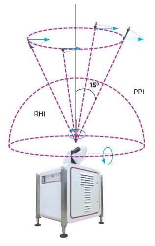
Figure 2: The Leosphere Windcube® LIDAR (Light Detection and Ranging) instrument is a vital part of the Acoem Integro™ LIDAR Network for measuring dust emission sources and dust movement over a scanned area up to 24 km in diameter.
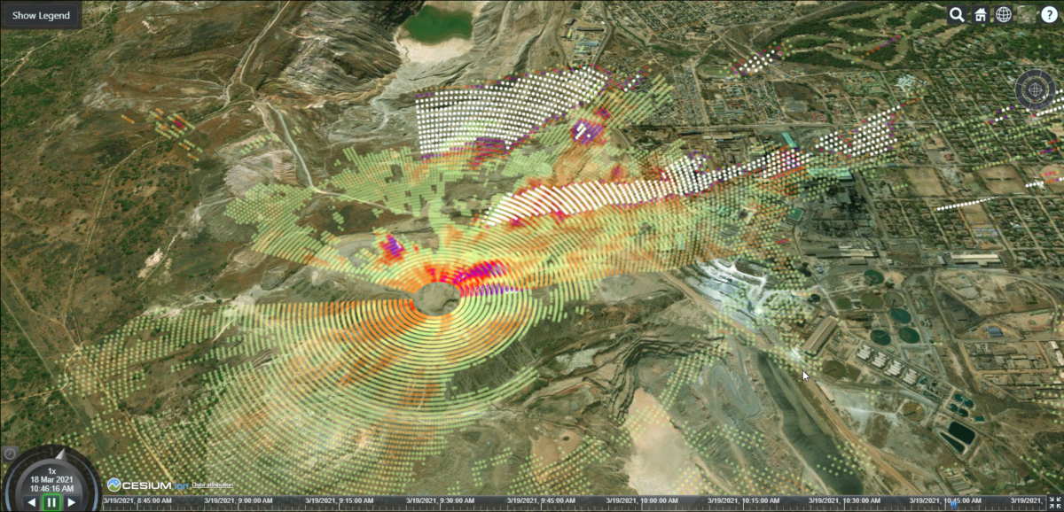
LIDAR technology precisely identifies all dust emission sources and dispersion trajectories. The fixed stations measure dust concentration to regulatory standards plus wind speed and direction and the Integro™ LIDAR Network uses these measurements to correlate the scanned data.
Integro™ LIDAR Network is currently being used in some of the world’s harshest and most remote locations. Suitable for a variety of applications, including mining, ports, infrastructure construction and community engagement, the system gives users full visibility over the particulate and dust concentrations on site.
“The Integro™ LIDAR Network isn’t just a compliance solution. It has evolved to become a critical operational tool. Adhering to government regulated dust levels is important, but so too is having greater insight into the safety of your workers, the health of surrounding communities and conserving resources,” commented Acoem Engineering, Research & Development Manager, Grant Kassell.
“The additional benefits of the Integro™ LIDAR Network include using its real-time information to inform effective and targeted dust suppression measures like sending out water trucks and being able to identify the exact source of emission exceedances to support process changes or prioritise remedial actions,” he concluded.